GEOTECHNICAL ENGINEERING
NEWBRIDGE
HomeGeophysicsSeismic tomography (refraction/reflection)

Seismic Tomography for Ground Investigation in Newbridge

Knowledgeable. Thorough. Resourceful.

LEARN MORE

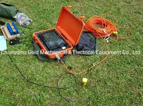
We have seen ground investigations in Newbridge stall because a desk study suggested uniform limestone bedrock, only for the excavation to hit a buried solution channel full of soft clay ten metres deep. That is a costly stop-start scenario. Seismic tomography — both refraction and reflection — removes the guesswork by imaging subsurface velocity contrasts before a machine bucket touches the ground. In a town built over Waulsortian limestone with a history of karstification, the difference between a competent rockhead and a collapsed doline can be just a few metres laterally. We use high-resolution seismic tomography to map that boundary, define rippability zones, and confirm rock mass quality for foundation design. The small additional upfront cost saves tens of thousands in redesign when the geology of the Liffey basin surprises you. For projects where bedrock depth exceeds 15 metres, we recommend combining the seismic survey with a targeted CPT programme to calibrate the overburden stratigraphy with a continuous mechanical log.

A velocity inversion in the seismic profile over Newbridge limestone is not a minor anomaly — it is often a dissolution feature that will dictate your foundation strategy.

Our service areas

How we work

Newbridge sits approximately 90 metres above sea level on the northern edge of the Curragh plain, where the bedrock surface undulates unpredictably beneath glacial till and fluvioglacial gravels. Our seismic refraction surveys typically deploy 24- or 48-channel geophone spreads with a sledgehammer source for depths to 30 metres, using first-break picking and tomographic inversion to generate 2D velocity sections. Reflection profiling adds deeper control when we need to identify sub-horizontal discontinuities or cavities below the refraction penetration limit. The velocity contrast between sound Waulsortian limestone (typically 3500–4500 m/s) and karstified or clay-filled zones (below 1800 m/s) provides a clear diagnostic signal. We process data with iterative ray-tracing algorithms, delivering profiles that the structural engineer can overlay directly onto site plans. Every survey is referenced to the Irish National Grid and tied to Ordnance Survey Ireland benchmarks, ensuring the geometry integrates seamlessly with civil design packages.
Seismic Tomography for Ground Investigation in Newbridge
Technical reference — Newbridge

Local considerations

A residential scheme near the River Liffey floodplain in Newbridge encountered a classic karst problem during piling. The boreholes suggested limestone at 8 metres depth, but three CFA piles in a row hit refusal at 3 metres on a pinnacle while the fourth pile plunged 14 metres into a soft infilled fissure. No seismic tomography had been performed. The result was an emergency redesign to a reinforced raft with a compressible void former under part of the slab. That single change consumed the entire geotechnical contingency budget. A two-day seismic refraction survey across the footprint before piling would have mapped the irregular rockhead surface and flagged the velocity anomalies immediately. We see this pattern often across County Kildare, where the limestone has been weathered along joint sets now filled with saturated organic silt. The seismic velocity section gives the design team a continuous image — not just a handful of point logs — so that differential settlement risk is assessed across the whole foundation area.

Need a geotechnical assessment?

Reply within 24h.

Email: contact@geotechnical-engineering.co

Video overview

Applicable standards

Eurocode 7 (EN 1997-2:2007) — Ground investigation and testing with geophysical methods, IS EN ISO 22475-1:2021 — Geotechnical investigation, sampling and groundwater measurement, Transport Infrastructure Ireland (TII) Publication GE-REQ-01 — Specification for geophysical surveys on national road schemes, Geological Survey of Ireland (GSI) — Karst database and bedrock classification guidelines for County Kildare

Technical data

ParameterTypical value
Typical refraction depth penetration (sledgehammer)20–30 m depending on overburden attenuation
Deep reflection profiling depth50–150 m with weight-drop or accelerated source
Geophone spacing for high-resolution surveys1–3 m (24 or 48 active channels)
Velocity range for competent Waulsortian limestone3500–4500 m/s P-wave
Velocity range for karstified or clay-infilled zones800–1800 m/s P-wave
Typical profile length per setup46–115 m (refraction), 100–300 m (reflection)
Coordinate reference systemITM / Irish Transverse Mercator (EPSG:2157)

Common questions

How much does a seismic refraction survey cost for a typical site in Newbridge?

For a standard residential or commercial site in Newbridge, a seismic refraction survey typically ranges from €2,200 to €5,350, depending on the number of profiles, the target depth, and the access conditions. A small footprint with one or two 46-metre spreads falls at the lower end. Larger sites requiring multiple setups, reflection processing, or integration with MASW surveys move toward the upper range. We always issue a fixed-price quotation after reviewing the site layout and the GSI karst data for your specific location.

Can seismic tomography detect small cavities in the limestone under Newbridge?

Detection depends on the cavity size relative to the depth and the geophone spacing. With a dense 1-metre geophone interval, we can resolve air-filled or clay-filled voids larger than about 2 metres in diameter within the top 15 metres. Smaller dissolution features may appear as velocity smears rather than discrete anomalies, and we flag those zones for targeted investigation. The Waulsortian limestone under Newbridge tends to produce elongated solution features aligned with joint orientations, which seismic profiles can image effectively when the survey line crosses the strike direction.

What is the difference between seismic refraction and seismic reflection for a Newbridge site investigation?

Seismic refraction maps the top of the bedrock and the velocity structure of the overburden by recording critically refracted waves along the ground surface. It works best when velocity increases with depth — which is typical in Newbridge where soft clay and gravel overlie limestone. Seismic reflection records waves that bounce off subsurface interfaces and is better for imaging deeper structures, sub-horizontal boundaries, and cavities that do not produce a clear refraction arrival. We often run both methods on the same spread: refraction to define the rockhead and rippability, reflection to look for deeper karst conduits or fault zones that could affect deep foundations.

Location and service area

We serve projects in Newbridge and surrounding areas.

View larger map